EuroSDR: Presentation
What kelluu is?
Kelluu delivers the world's most accurate environmental data from vast areas more affordably and faster than any other alternative by using autonomous and emission-free airships.
We have the world’s northernmost airship factory and the largest autonomous airship fleet in the world. Kelluu is a Finnish company, currently employing around 50 people. The company is based in Joensuu.
Our airships
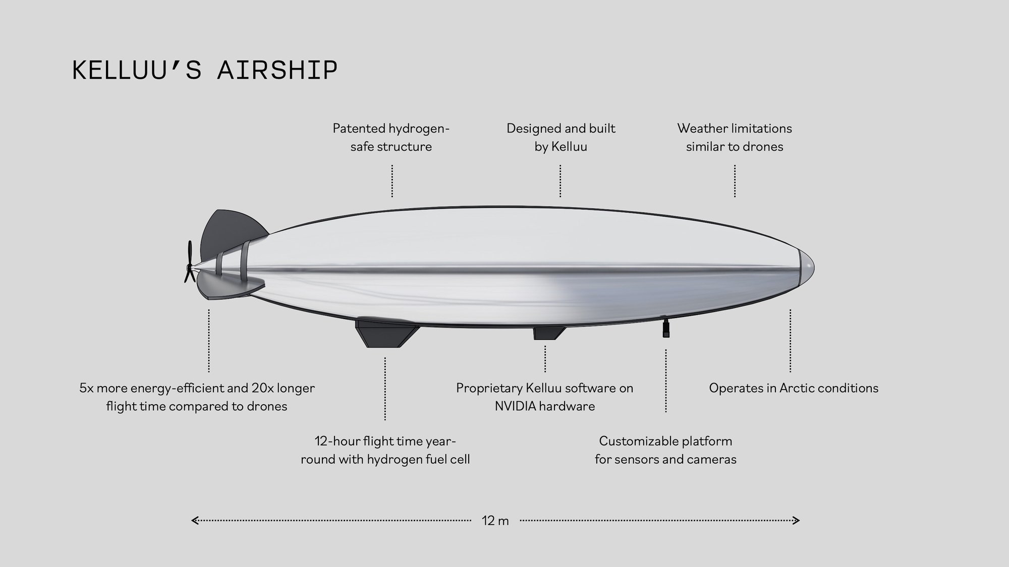
Kelluu’s airships are 12 meters long and run on hydrogen. This enables zero-emission flight times of up to 12 hours and year-round operation, even in extremely cold conditions. Different sensors and cameras can be attached to the airships depending on the type of environmental data needed. Flying at an altitude of around 120 meters, the airships are silent and do not cause noise pollution like drones, airplanes, or helicopters. Our airships can also be linked into a swarm to collect a massive dataset at once.

Our data
Kelluu’s airships capture more accurate data over large areas than standard methods. With Kelluu’s technology, results can be achieved where one pixel on the screen corresponds to one centimeter in the real world. The material captured by the airships is used to create a detailed 3D model of the environment, known as the area’s digital twin. Kelluu’s digital twin can be used to study, analyze, and measure various features of the environment. It also serves as a platform for uploading raw data. The accurate data captured by Kelluu enables fast AI-powered analysis of environments and, for example, the prediction of potential risks.

Use cases
Kelluu’s technology is already being used for forest research, urban planning, industrial site development, monitoring of critical infrastructure, and supporting defense and surveillance technologies. Kelluu was one of 70 companies selected for the NATO DIANA program out of 2,600 applicants.
our future
Kelluu is turning the real world into a digital one, with accuracy down to the smallest detail. Imagine a near future where everything you see can also be explored again through data delivered by Kelluu. Every building in every city, every tree in every forest, every power line in every electrical grid.
Kelluu transforms data into knowledge and understanding of how different environments behave. For better development and improved safety. For more accurate analysis and prediction. Our data is the foundation for sustainable and secure societies.
By providing centimeter-level environmental data, Kelluu enables more precise AI development. It allows smarter models to be trained on real, high-resolution environments. This is how we build an API to Earth, a digital layer that helps us understand, protect, and shape the world with more care and clarity.


Image taken from the airship

Kelluu's airship over City of Joensuu

SUBSCRIBE FOR KELLUU UPDATES
Yes! Keep me updated about Kelluu’s news and job opportunities.